![US forces conducted a CJADC2 demonstration to highlight the ability to integrate network solutions and connect multiple sensors to a common operating network, presenting warfighters with an information advantage across all warfighting domains. [US Air Force]](/ssc_fa/images/2026/04/29/55687-_108__cjadc2-600_384.webp)
The US Navy is constructing a persistent "invisible cordon" around Iran by digitally mapping the entire maritime theater through fused sensors and advanced AI.
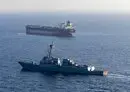
Using Project Maven and the Combined Joint All-Domain Command and Control (CJADC2) network, commanders now track activity across the region with near-real‑time precision.
Officials say the approach allows a smaller, more agile fleet to achieve what once required large, static formations.
Central to the effort is a focus on the Islamic Republic's so‑called "ghost fleet," which uses false transponders and deceptive routing to move sanctioned oil.
AI models compare historical Automatic Identification System (AIS) patterns with satellite imagery and signals intelligence to flag tankers attempting to obscure their identity.
When anomalies appear, the system automatically highlights likely destinations and calculates arrival windows for potential boardings.
This predictive method lets crews intercept vessels with significantly fewer patrol hours than traditional search patterns required.
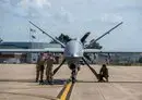
High‑altitude RQ‑180 surveillance aircraft and E‑2D Hawkeye crews feed continuous visual and electronic data into the Maven architecture.
Officials describe the resulting sensor picture as a "digital grid" covering the full length of the Iranian coastline.
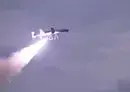
CENTCOM has also increased its reliance on small autonomous systems to expand situational awareness.
Hundreds of low‑cost drones operate as mobile tripwires, alerting nearby forces when suspicious traffic leaves Iranian ports.
Manned ships, including elements of the USS Abraham Lincoln strike group, then position themselves to conduct time‑sensitive stops.
The blockade's reach extends well beyond the Gulf, aided by CJADC2's ability to trace ship ownership instead of relying only on flags.
This approach has enabled CENTCOM to identify Islamic Republic‑linked vessels traveling as far away as the Pacific, officials said.
Commanders report that 13 ships from multiple nations have been intercepted or redirected under the initiative as of April 16, 2026.
For Islamic Republic leaders, analysts say the message is clear: the United States is not merely watching the region.
It is mapping it, digitizing it and using that comprehensive picture to guide every intercept with full‑force efficiency.